
 |
Home | Gauri Shankar and Menlungtse Main | References | Contact |
Last Updated: January 2009. Click on an image to see the FULL size with a caption.
The times shown are the actual trekking times including photo stops, but not including rest or lunch stops. The altitudes are mainly from Lonely Planet. The weather was generally sunny in the morning, but often cloudy in the afternoon, with temperatures at higher altitudes around -10C overnight to 10C in the daytime.
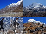
My crew on the Tashi (Tesi) Lapcha Pass:
Front: Guide Gyan Prasad Tamang - my seventh time with Gyan; Jerome Ryan in the middle, Climbing Sherpa (for Tashi Lapcha) Palden - his third time with me.
Back: Porter and cook's helper Dumbar, Cook Chandraman - his second time with me, Porter and cook's helper Pasang.
The routine is almost the same each day. I get up around 5:30; bed milk-tea is at 6:00 followed by washing water at 6:15 and breakfast at 6:30. We are on the trail around 7:00, reaching our lunch spot after three to four hours. The afternoon trek is shorter, around two to three hours. I then read a book and have afternoon milk-tea and cookies. Soup and a snack like papadam or popcorn is served around 18:00, followed by dinner. When the crew starts to eat their dinner, usually dhal bhat, I head for bed around 19:00.
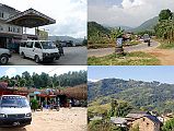
I met my guide Gyan at the airport, and we drove in a private bus out of chaotic Kathmandu on the highway to Tibet. We turned off the highway and drove on in the rain to Dolakha (1660m), a large bazaar town at the end of the paved road. The overnight temperature in Dolagha was 15C.
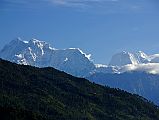
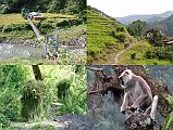
Near the beginning of the steep and slippery (from yesterday's rain) descent from Dolagha (1660m), there was a wonderfully clear view of Gauri Shankar and Menlungtse above the intervening ridges to the northeast. It took 80 minutes to descend to the suspension bridge over the Doni Kosi (800m) and climb briefly to Malepu (880m). The trail was fairly flat and easy along the Tamba Kosi, taking another 105 minutes to Piguti (920m), where we had lunch. It rained over lunch but cleared off in the afternoon.
The trail from Piguti jumped up and down to avoid cliffs and landslides, taking 55 minutes to reach Singati (950m). After 35 minutes from Singati the trail reaches a bridge and a small village on the far side, and after another 25 minutes brings the village of Suri Dhoban (1030m). The afternoon temperature was 22C and the overnight temperature was 18C.
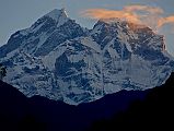
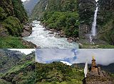
There was a perfect view of the two summits of Gauri Shankar at sunrise from Suri Dhoban towards the head of the valley. The trail from Suri Dhoban was fairly easy, reaching a teahouse in 30 minutes, with views of Gauri Shankar ahead. The easy trail continued for another 80 minutes to Manthale (1070m), and after another 15 minutes crossed a suspension bridge over the Tamba Kosi and into Jagat (1150m). The trail from Jagat has many ups and downs, entering a steep walled gorge with countless waterfalls, with the mellow Tamba Kosi turning into a thundering whitewater. You can see the the new road from Singati to Lamabager being built in various stages. The trail continues, joining the trail from Barabise, and reaches Gongar (1440m) after 70 minutes, where we had lunch.
In the afternoon the trail took 45 minutes to reach a Chechet (1524m), with a beautiful waterfall. The trail descends to the river, crosses the suspension bridge, and ascends on a new set of steps built with Japanese support to the picturesque village of Simigaon sprawling over a terraced knob (1600-2000m). The trail took 55 minutes to reach the first houses of Simigaon and another 40 minutes to reach the gompa on the Simigaon saddle (1990m). The mid-day temperature was 25C and the overnight temperature was 15C with lots of rain.
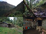
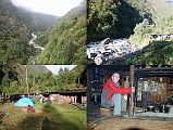
The excellent view of Gauri Shankar from Simigaon remained hidden beneath the clouds. The Daldung La hasn't been used in a few years because of landslide danger, so I used the normal lower route. The trail from Simigaon enters the Rowaling valley, climbing steeply for two hours to Shakpa Kharka (2660m). I had my first experience with leeches, one getting under my pants to suck the blood from my leg. Gyan ripped him off, leaving a splotch of dried blood on my leg.
After an early lunch, the trail took 75 minutes to climb to Gyalche Kharka (2990m), before taking 30 minutes to descend to the Rolwaling Chu and the Dongang Kharka (2800m). The clouds kept the daytime temperatures at a cool 12C. It rained in the afternoon, with a cool overnight temperature of 8C.
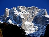
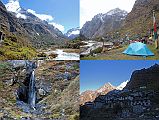
From Dongang Kharka, the trail goes up and down following the Rolwaling Chu for 2:55 to a bridge where the Daldung La trail joins the main trail. Along the way there were some good views of the enormous steep south face of Gauri Shankar. Prayer flags and katas in the trees mark the Samtar Gora, a site sacred to many Hindus as well as Buddhists. The trail took 30 minutes to reach Nyimare (3600m), and another 45 minutes to Beding (3690m).
There were excellent views of the Menlung La and Chegigo (6257m) on the way. I decided not to try the climb to the Menlung La for its spectacular view of Menlungtse in Tibet because I could see from the closeup telephoto image that the pass was choked with snow and ice.
Beding is the biggest village and the center of the Rolwaling valley with the houses built on the hillside, with Gauri Shankar poking its head above the intervening ridge. The small Beding gompa is situated at the beginning of town, with some fine thankas painted in 1960 by the famous artist Kappa Kalden from Khumbu. It reached 15C in the early afternoon before rain cooled it down. The overnight temperature was -2C.
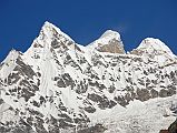
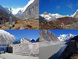
The trail from Beding climbs gradually in two hours to Na (4100m), where the Rolwaling Valley opens out into the classic glaciated U-shape. The trail from Na is flat and easy for 50 minutes to the Sangma Kharka (4200m), where we had lunch. The icy face of Tsoboje (Chobutse, 6689m) rises directly above the Kharka.
The trail from Sangma Kharka climbs steeply for 45 minutes above the river to reach the buildings at the head of the dammed Tsho Rolpa (4540m). This giant glacial lake had been a threat to breach its natural dam and flood the valley below, but there is now a deep trench cut into the terminal moraine to control the water level. The trail follows the south side of the terminal moraine of the Trakarding Glacier to a campsite at Kabug (4560m) in 30 minutes. There are very good views of the surrounding peaks include Tsoboje (Chobutse, 6689m) and Dragker-Go (6793m) to the north, Bigphera Go Shar (6729m) at the head of the valley, and Kang Nachugo (6735m) back down valley. After a failed attempt on the south face, Kang Nachugo was climbed for the first time just a week later on October 17, 2008 by Americans David Gottlieb and Joe Puryear via the West Ridge. The afternoon temperature was 9C and the overnight temperature was a cold -12C.
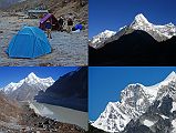
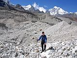
From Kabug, the trail climbs steeply above the Trakarding Glacier for an hour before descending in another hour to the glacier. The rough trail goes on the Trakarding glacier climbing, descending, and zigzaging between thousands of sharp rocks, stones, sand-heaps and ice-walls. It then follows the north side of the glacier to a camp on the glacier in 2:20, just below the steep rocks to the Drolambau glacier. The afternoon temperature was 6C; the overnight temperature -6C.
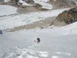
A brutal day, but certainly a highlight. The trail quickly left the Trakarding Glacier and climbed steeply over some scary rocks to reach the Drolambau Glacier in 85 minutes. The climbing Sherpa Palde had to hold my hand through some of the trickier sections. It took another 80 minutes to reach the bottom of the snow slope leading to the Tashi Lapcha pass. The temperature was a cool -9C until the sun finally hit us on the ascent to the pass. As the snope slope increased in steepness, Palde cut steps to ensure we had a safe place to step and not fall back down the face. We reached the top of the Tashi Lapcha pass (5755m) after a gruelling 90 minute ascent on the steep snow slope. The view west to Rolwaling, south to Parchamo (6273m), and north to Drangnag Ri (6801m) at the head of the valley and Tengi Ragi Tau (6943m) directly above the pass were very good, but the view towards Everest was disappointing with a ridge blocking the view and the clouds rolling in.
From the Tashi Lapcha pass the trail goes downhill on snow until we reached a tricky steep section. Palde fixed some ropes and we descended. Even with the rope I still fell five or six times on the snow descent. The trail finally leaves the snow behind, passes glacial Parchemuche Tsho lake, before my energy gave out and we decided to camp at about 4800m after 2:40 from the pass. The afternoon temperature was 4C; the overnight temperature -5C.
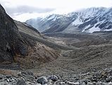
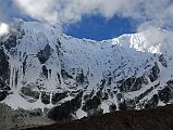
In mostly cloudy weather, the trail was fairly easy descending from our camp to Thengpo Kharka (4230m) in 65 minutes. The trail was even easier, taking another 65 minutes to reach the interesting Thame gompa. We stayed in Thangmoche (3840m), just over the ridge north of Thame (3820m). The afternoon temperature was 12C and the overnight temperature was -3C.